
Erläuterung zu den Grafiken
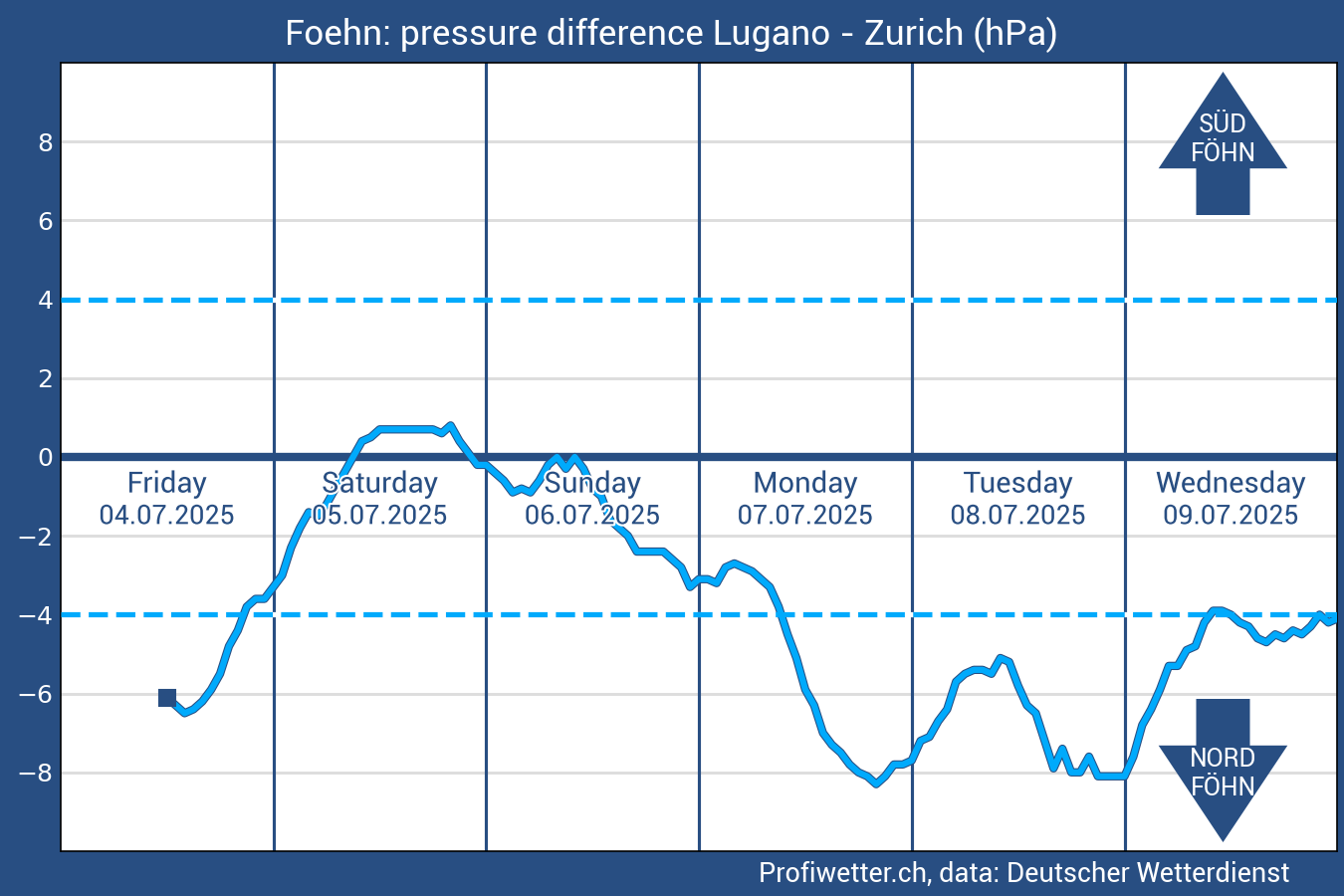
The forecasted pressure gradient (unit hectopascal, hPa) between Lugano and Zurich, on the basis of the MOS-data of the German Weather Service DWD, shows the flow over the Alps. If we have a negative pressure gradient, that means the surface pressure in Zurich is higher than in Lugano, north foehn comes up over the Alps (wind from north). In the contrary case we have south foehn (wind from south). The intensity of foehn winds increases with larger pressure gradients.
Empirically we need at least a pressure gradient of 4 hPa for the breakthrough of foehn winds in the alpine valleys and at least 8 hPa for the breakthrough in the adjacent lowland.
The forecast is based on model output statistics (MOS) by Deutscher Wetterdienst and is updated several times a day.